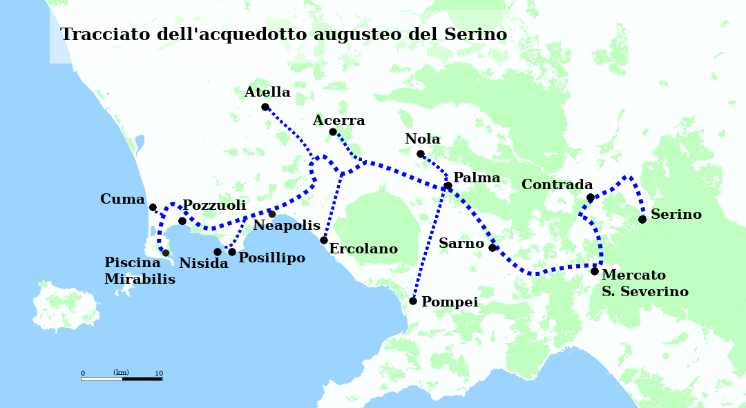
Beneath the densely layered urban fabric of Naples, a water distribution system built more than 2,000 years ago remains the most extensively documented example of multi-city Roman hydraulic infrastructure. The Aqua Augusta — formally the Aqua Serino, named for its source — was engineered to supply not one city but a network of at least eight settlements around the Bay of Naples, a design without known parallel in the Roman world.
Origins and Construction
Marcus Vipsanius Agrippa, curator aquarum under Emperor Augustus, oversaw the construction of the aqueduct sometime between 33 and 12 B.C. The project drew water from natural springs at Serino, in the Campanian Apennines approximately 51 kilometres east of Naples. These springs had been valued for their purity long before Roman engineering redirected them on a large scale.
The main line ran more than 90 miles in total, including all branch segments. Most of the route used open channels and brick-arched bridges where terrain permitted. Where the ground rose steeply or crossed populated areas, engineers carved tunnels directly into soft rock — tufa limestone and volcanic tuff being the predominant materials in the region. No pumping mechanism was involved. Water moved entirely by gravity, the channel maintaining a consistent gradient calibrated across decades of surveying work.
Ten Branches, Eight Cities
What distinguished the Aqua Augusta from contemporaneous Roman aqueducts was its branched architecture. From a primary distribution point, ten separate lines diverged: seven directed toward urban centres and three supplying large private villas along the coastline. The urban branches served Naples (then Neapolis), Pompeii, Herculaneum, Cumae, Puteoli, Misenum, and Nola. Each branch terminated at a castellum aquae — a distribution tank — from which lead and terracotta pipes carried water to public fountains, bathhouses, and private connections.
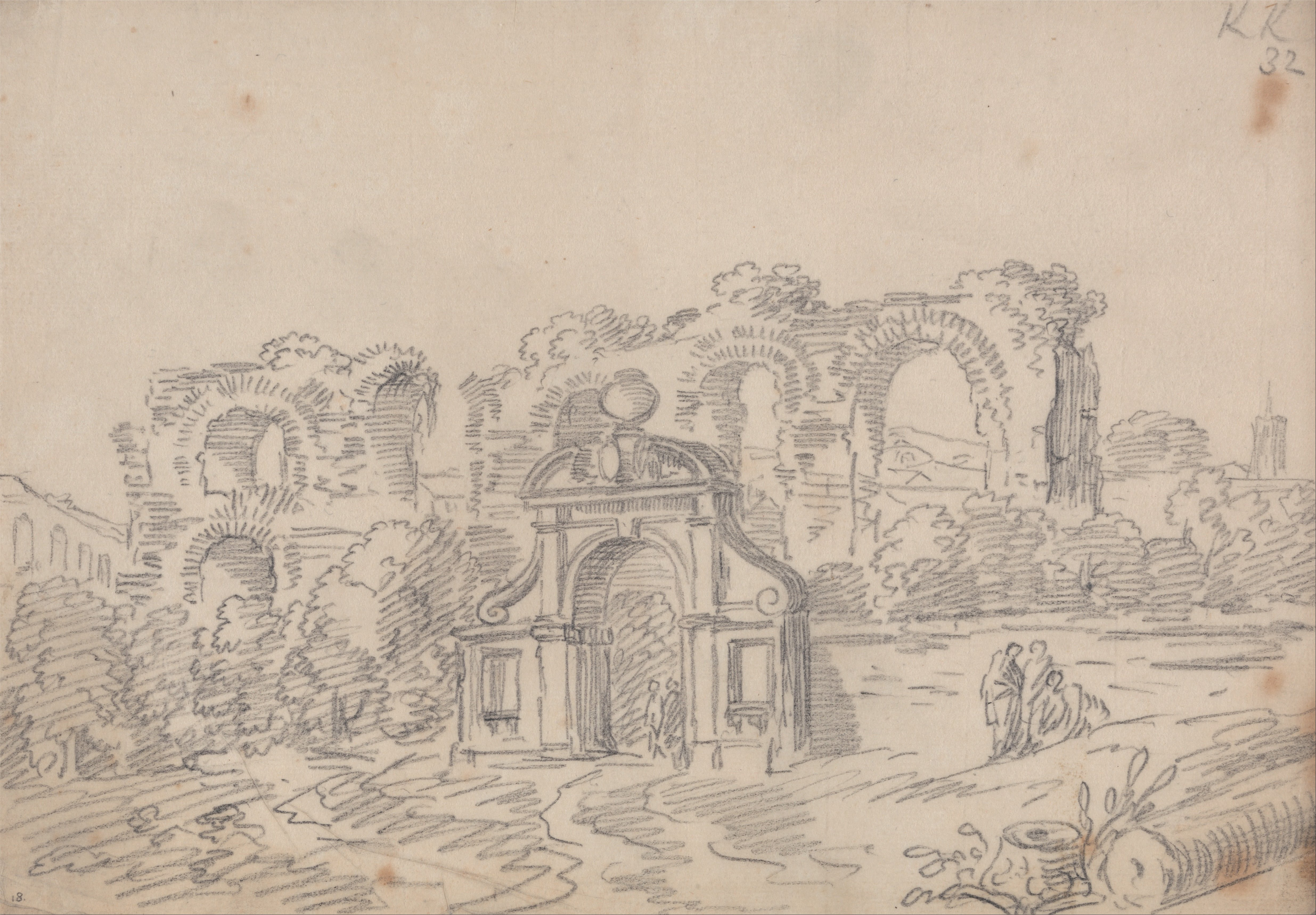
At the urban level, Naples received water through a network of underground channels that ran beneath streets and building foundations. These sub-street conduits fed the city's public basins and, in later centuries, were incorporated into private cistern systems as the city's population density increased. The Napoli Sotterranea complex, now accessible to the public, preserves portions of these channels alongside Greek-era quarries and World War II air-raid shelters — a vertical stratigraphy of Neapolitan underground use spanning 2,400 years.
The 2022 Rediscovery
Despite its scale, the Aqua Augusta remained the least systematically documented of all major Roman aqueducts. Sections had been identified intermittently since the 19th century, but large portions of the original route had no verified physical record. That situation changed in late 2022, when speleoarchaeologists from the Associazione Cocceius rediscovered a previously unknown section running beneath Posillipo Hill, on the western edge of Naples.
The rediscovered stretch measured 647 metres — the longest continuous uninterrupted section of the Aqua Augusta confirmed to date. The tunnel ranged between 52 and 70 centimetres in width, with a ceiling height sufficient for maintenance access. The interior walls retained their hydraulic plaster coating intact across most of the length, along with limestone mineral deposits characteristic of slow-moving freshwater over centuries. A detailed account of the 2022 exploration appeared in Arkeonews and was confirmed by the Soprintendenza Archeologia, Belle Arti e Paesaggio per il Comune di Napoli.
Distribution at Street Level
Roman water management in Naples followed a tiered hierarchy. At the top of the pressure gradient sat the castellum aquae, typically positioned at an elevated point in the urban grid. From there, primary pipes — usually lead, occasionally terracotta for lower-pressure sections — fed secondary distribution points. Public fountains, the most numerous water access points, were fed by constant overflow from these secondary nodes; the flow was not shut off but ran continuously, with excess water draining to street gutters and eventually to the sea.
Private connections required a permit and were metered by pipe bore size rather than volume. Bathhouses, which consumed water in large quantities for heating systems and plunge pools, received dedicated supply lines. In Pompeii, where the distribution network is the best-preserved example from the Bay of Naples region, archaeologists have mapped 14 public fountains fed by the Aqua Augusta, spaced so that no residential block was more than 80 metres from a public water point.
Maintenance and Operational Continuity
The scale of the Aqua Augusta created maintenance demands that occupied a dedicated workforce. Access points — vertical shafts called specus — were cut at regular intervals along the underground sections, allowing workers to descend for cleaning, replastering, and sediment removal. Calcium carbonate deposits, which accumulate at rates of several millimetres per decade in hard-water systems, required periodic mechanical scraping to maintain channel capacity.
The aqueduct continued to function in some form into the Byzantine period, likely the 6th or 7th century A.D., though documentary evidence for its maintenance after the 4th century is sparse. Medieval Naples drew water primarily from shallow wells and cisterns, as the infrastructure for maintaining the longer aqueduct lines fell outside the administrative capacity of the city's post-Roman governance structures.
Current State of Knowledge
Systematic documentation of the Aqua Augusta remains incomplete. The 2022 Posillipo discovery was notable precisely because it added a substantial, previously unrecorded section to the known record. Italian archaeological authorities have expressed interest in expanding subsurface survey work along the estimated route, but urban development constraints — the aqueduct runs beneath densely occupied residential and commercial areas — complicate access.
The accessible portions of the Napoli Sotterranea network receive approximately 500,000 visitors per year and have become one of the primary public-facing contexts in which the Roman water infrastructure is explained and interpreted. The remainder of the network, including the Posillipo section, is not open to general access and continues to be studied under controlled archaeological conditions.
Sources: Napoli Sotterranea; Arkeonews; Science Times; Imperium Romanum.